The benefits of avian radar for EIAs:
- Understand bird movements
- Provide accurate altitude data
- Assist species identification
- Broad coverage
- Continuous monitoring
- Assess collision risk
- Detailed insights
- Long-term analysis
- Automated turbine shutdown
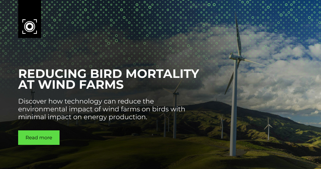
Wind farms are an essential part of the global renewable energy network. From Europe to America, these towering turbines line our shores and flank our motorways, delivering clean electricity to our homes. But there's a careful balance at play.
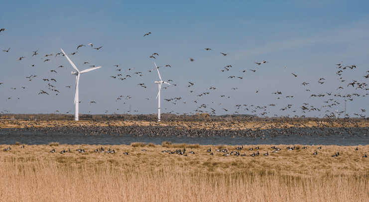
While wind farms reduce our reliance on fossil fuels, they also pose a threat to birdlife. Aside from fatal collisions with turbine blades, wind farm sites often encroach on critical migration routes. Not to mention important breeding, nesting, and feeding sites.
Detailed wind farm environmental impact assessments (EIAs) are essential to ensuring harmony between turbines and birdlife at your site. But the level of detail you go into depends on the quality of the technology at your disposal.
Here are 9 ways wind farm bird radar helps you conduct more comprehensive EIAs.
9 Ways Avian Radar Improves Wind Farm Environmental Impact Assessments
1. Understand Bird Movements
The most advanced bird radars can detect and track thousands of birds simultaneously, giving you access to accurate real-time data on bird:
- Size
- Altitude
- Speed
- Flight path
Insights like this help you map migration patterns and flight behaviours, so you can take appropriate steps to minimise your site’s impact on birdlife. For example, installing humane bird control and dispersal devices in high-traffic areas.
2. Provide Accurate Altitude Data
Bird altitude data is a key component in risk collision modelling. This data provides clear insight into the time birds spend in the rotor-swept-zone (RSZ). As the name suggests, an RSZ is the circular area covered by the rotating blades of a wind turbine. Birds that enter this zone are at a significantly higher risk of collision.
3. Assist Species Identification
Specialised radar systems distinguish between large, medium, and small birds. By combining size data with other observational insights, researchers can identify bird species with greater accuracy – enabling more targeted conservation efforts.
4. Broad Coverage
Radar provides the broadest coverage of any sensor due to its superior range and ability to identify objects even at night. For example, our MAX avian radar has an instrumented range of 9.3 miles (15km) and can detect and track large birds within a 5-mile (8km) radius under optimal conditions.
Superior detection range gives you early warning of approaching birds, so you can take steps to divert them away from your turbines.
5. Continuous Monitoring
Unlike cameras and other visual detection methods, 360° avian radar provides reliable coverage day and night. This gives you an uninterrupted view of bird activity in your airspace for more detailed wind farm environmental impact assessments.
6. Assess Collision Risk
Advanced avian radar allows users to visualise bird data for quick and easy analysis, helping you develop more effective risk collision models, faster. Dynamic data visualisations allow you to assess things like bird collision risks against turbine placement and other environmental factors that can impact birdlife.
7. Detailed Insights
Radar comes into its own when you pair it with human expertise. Combining radar data with manual observations, such as environmental conditions and species diversity, reveals even more about bird behaviour and the factors that impact them. To streamline this process, advanced radar systems integrate with intuitive tools that let you add manual observations to bird tracks in real time.
8. Long-term Analysis
Dedicated bird radars have precise detection abilities. Coupled with vast databases, they’re ideal for deep analysis and predictive modelling. For example, historical data provides long-term, cumulative insights that enable you to develop effective and resilient bird control protocols.
9. Automated Turbine Shutdown
Integrating bird radar with automated turbine shutdown technology turns it from a passive detection system into a fully fledged mitigation tool.
For example, you can integrate a shutdown on demand (SDOD) plug-in with your wind farm’s supervisory control and data acquisition (SCADA) system to suspend individual or groups of turbines upon detecting hazardous bird activity. Once the threat’s passed, the turbines restart – minimising the impact on energy output.
Balancing Progress with Protection
With detailed flight behaviour data, accurate collision risk assessments, and real-time hazard warnings, avian radar enables you to conduct the most thorough wind farm environmental impact assessments.
This precision allows you to focus protective measures where they're needed most, rather than implementing blanket restrictions that impact productivity unnecessarily.