Robin Radar Systems
Laan van Waalhaven 355
2497 GM
The Hague
The Netherlands
T +31(0)8 8700 8700
info@robinradar.com
Contents
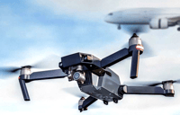
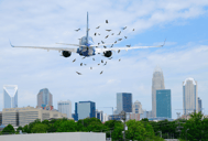
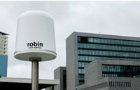
Robin Radar Systems BV is technology leader for tracking and classification of small targets. Our mission is to provide actionable information that increases flight safety for both humans and birds. We do that by combining purpose built radars with unique software algorithms.
Systems are currently operational at airports as well as wind farms in Bulgaria, Denmark, Finland, Germany, Italy, Norway, Poland, Switzerland, Spain, The Netherlands and Turkey. We achieve leadership in global niche markets by turning customers into ambassadors.
Our heritage is more than 30 years of applied science. Robin was spun out of the well-respected Dutch Research Institute for Applied Science (TNO) in 2010. The company name derives from the original project name: Radar Observation of Bird INtensity (ROBIN).
However, we do not take our leading position for granted. Listed in the top-3 of most innovative Dutch companies, we continuously innovate.
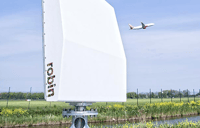
As front-runner in radar ornithology, we want to work with state-of-the-art technology. We think Max is the most advanced avian radar of its time.
– Eelco Waardenburg, Director of Bureau Waardenburg
It took more than four years, thousands of
coffees and millions of euro’s to get there.
The result is mind-blowing. We simply had
no other choice, ...than to call it MAX®
MAX® has the fastest rotation speed in the market, resulting in track updates every second. This allows unprecedented 3D visualization of flight paths by exporting tracks into Google Earth.
MAX® is a single sensor system, providing full 3D information of all avian targets around. All birds have height information and there is virtually no ‘cone of silence’ above the radar. The system provides 360-degree coverage from the horizon to 1 kilometer above.
MAX® is entirely purpose built to monitor birds. The antennas are specifically designed to do so. It brings Phased Array radar technology into the hands of bird control units and ornithologists.
Having full 3D capabilities is crucial for us. That's why we choose MAX®
– Camilla Rosenquist, Wildlife Manager
MAX® minimizes infrastructure requirements. The computer servers can be placed in already existing server rooms. In other words, at the location of the radar, no shelter or housing is required. All MAX® needs is normal power and internet network.
Bird movements are displayed in real time on a PC or mobile device. MAX® works on commercial tablets based on IOS as well as Android.
Developing new hardware is not the only thing we have done. Our customers often need to convert bird data into reports. We have developed an entire new tool to make appealing graphics in a user friendly way. Just select the variables and time period you want, and the tool will immediately generate a graphical representation.
Technology | FMCW |
Frequency | X-Band |
Power Output | 20W |
Rotation/ Scan Speed | 60rpm / 1s |
Instrumented Range | 15km |
Azimuth Coverage | 360-degrees |
Elevation Coverage | 60-degrees |
Dimensions (WxDxH) | 1237 x 654 x 1660mm |
Weight | 325kg |
Find out how our radars can make your operations safer with actionable data. Get in touch today.
TALK TO SALESRobin Radar Systems
Laan van Waalhaven 355
2497 GM
The Hague
The Netherlands
T +31(0)8 8700 8700
info@robinradar.com
Reg: 27371517
VAT: NL822016321B01
ISO 9001 Certified
ISO 27001 Certified