Bird radar information is logged in real time and is used for data analysis over a given period of time. ROBIN’s specific software applications, created in close harmony with its users are described below.
See Bird Movements In Real Time (The “Visualiser”)
The “Visualiser” displays bird movements on a map in real time. Users can orientate by using a Google background or a customized map with important landmarks and are able to zoom in on a specific bird track that represents its flight path. These tracks have different colours to distinguish high-risk birds from low(er)-risk birds. The circle at the end of the track is the bird’s present location. With the size of the circle reflecting the size of the bird. The figures next to the circle show the bird’s speed, height and exact distance from the radar. All this information is in accurate meters and is continuously logged into a database to facilitate analysis (see “Report Viewer”). The Visualiser contains a playback-mode that allows you to browse through the entire database and review earlier events.
Display Information In Vehicles (The “Mobile Viewer”)
Real time bird information can also be made available on commercial off-theshelf tablet PC’s for use in vehicles. The display can provide alerts if high-risk birds are about to enter a critical zone. This critical zone is a pre-defined area, customised in conjunction with the CAA and easy to modify if new insights are gained. In addition to individual birds and their flight paths, the Mobile Viewer can also display an activity grid, showing where there has been a lot of bird activity during the past 30 minutes. This provides a general insight into the severity of bird movements at that time and helps to determine what area to focus on.
Control The Radar From A Distance (The “Remote Monitor”)
The Remote Monitor is used to monitor the current state of the system. It automatically performs checks on various components of the system and shows the results in a graphical user interface. The tool is used to recover from minor system failures by restarting the applicable (sub-) system or even by remotely rebooting a server.
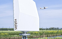
Robin Radar has developed a system that detects birds at great distances
– Peter Hartman, (former) CEO of KLM
Convert Data Into Graphs (The “Report Viewer”)
Bird strike mitigation at an international airport is a complex matter for the many stakeholders involved. This is one of the reasons why measuring, logging and reporting are important. To support this, ROBIN has developed a unique tool called the “Report Viewer”.
All track data is stored in the PostgreSQL database. The tool generates basic graphs from the database. This not only involves track information, but also system uptime graphs and weather information. Furthermore, the tool enables database snapshotting for export to advanced COTS database analysis tools.
The Report Viewer is webbased, which means that it can be used remotely on a desktop in a comfortable office environment. The possibilities are numerous. Some examples of graphs are shown below.
-
Quantify patterns in behaviour (migration routes, seasonal occurrence and the impact of
-
Create quantified data as input for habitat management discussions with stakeholders
-
Identify key areas (breeding, feeding, wintering, roosting etc.)
-
Measure the effectiveness of mitigation policies